")
")
")
")
")
")
")


Itinerary - India : Spiti - Ladakh
High Himalaya
Day 1: Arrive Chandigarh
redspokes Spiti to Ladakh cycling tour begins in Chandigarh. You will be met at the airport on arrival and transferred to your hotel. Chandigarh, ‘The Beautiful City’ is regarded as India’s best planned metropolis. Le Corbusier and Nehru number amongst the conceptualists who contributed to its realisation as a prosperous aesthetically pleasing, contemporary Indian city. Chandigarh exemplifies the co-existence of urbanity and nature, with vegetation as much a part of the fabric of the city as the buildings themselves. The climate here can be extreme with an uneven distribution of rainfall. The roads in and around Chandigarh are surrounded by trees and it has the third highest forest cover in India. This evening we will have a group briefing.
Accommodation: Hotel
Altitude: 350m
Day 2: Chandigarh - Shimla - Rampur
Today we will transfer to Rampur, passing through Shimla, capital of the Himachal Pradesh region. Surrounded by green hills with snow-capped peaks, Shimla is a popular tourist destination during the summer months. The British regarded Shimla as the summer capital of India and traces of the colonial era remain. The name Shimla is believed locally to originate from Shyamali Devi, a re-incarnation of the Goddess Kali. After a stop to look around Shimla we continue on to Rampur our destination for the night.
Altitude: 350m (1,148ft)
Accommodation: Hotel
Day 3: Rampur to Reckong Peo
Today we continue our transfer by vehicle to Reckong Peo, climbing ever higher along a beautiful scenic route. The meandering mountain road is literally cut out of hillside. The Sutlej gorge lies to one side of the road with lush greenery and cloud cloaked peaks above. We will enjoy glorious views of the pine forested Kinnaur Kailash range.
Accommodation: Hotel (B)
Altitude: 2,290m (7,513ft)
Day 4: Reckong Peo – Acclimatisation Day
Known simply as Peo by the local inhabitants Reckong Peo is 260 km (162 miles) from Shimla at an altitude of 2,290 m. 8km from Rekong Peo is Kalpa (formerly known as Chini) A picturesque village with gorgeous scenery all-around of the Kinner Kailash massif that have changed little in the last 500 years and panoramic views from behind the Chorten (Tibetan Pagoda) at the top of the hill. The Narayan Nagini Temple Complex, has shrines of Hindu, Buddhist and local deities. The Chilgoza tree is found in abundance here. A member of the pine tree family, the fruit is enclosed in a soft skin. Other than Kalpa, the Chilgoza grows only in Turkey and Iraq. You have time today to visit the village.
Accommodation: Hotel (B,L,D)
Altitude: 2,290m (7,513ft)
Day 5: Reckong Peo - Puh
We set off this morning for our first day of riding. We cycle on mostly flat road with a few gentle ascents to Puh passing apple and apricot orchards. At the village of Akpa our Inner Line permits will be checked which takes about half an hour. From Akpa there is a mixture of newly paved and unpaved road and we have to make our way cycling with care as the area is prone to landslides. We finish the day with a 6 km climb riding a series of zigzags to the village of Puh.
Cycling Distance: 68km (42 miles)
Altitude: 2,950m (9,678ft)
Accommodation: Guest House (B,L,D)
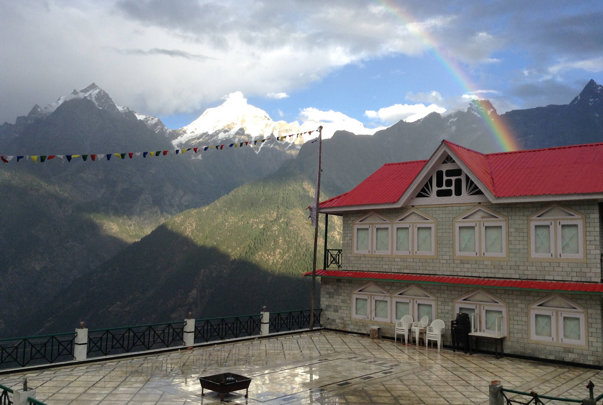
Day 6: Puh to Nako
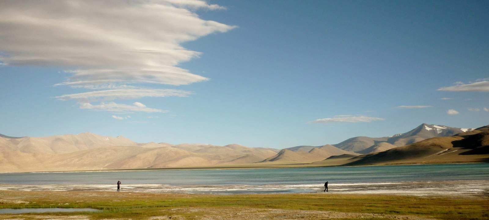
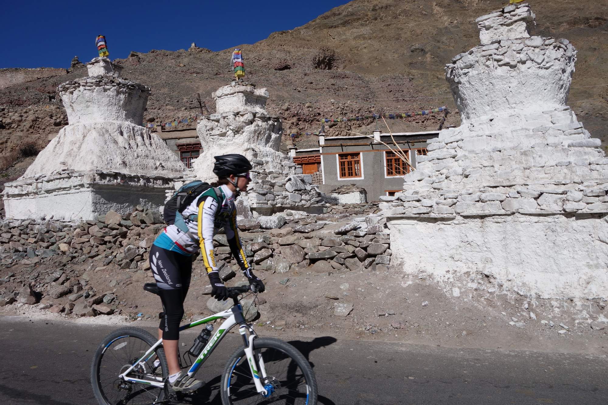
Our route on the tour today is a mixture of steep up and down stretches as we cycle as far as Dubling Bridge. From here we ride on a combination of rougher road and newly sealed tarmac to the start of the Spiti Valley. After crossing a bridge into the valley we ascend cycling a spectacular narrow route cut into the vertical rock face to the tiny village of Ka, then riding uphill following a series of hairpin bends all the way to Nako, all on recently surfaced road. We have time this evening for a lakeside stroll, during twilight hours large numbers of birds flock to the lake. We can also visit the 11th Century Nako monastery. On a clear night here, you will enjoy an amazing starry sky.
Cycling Distance: 50km (31 miles)
Altitude: 3,900m (12,795ft)
Accommodation: Guest House (B,L,D)
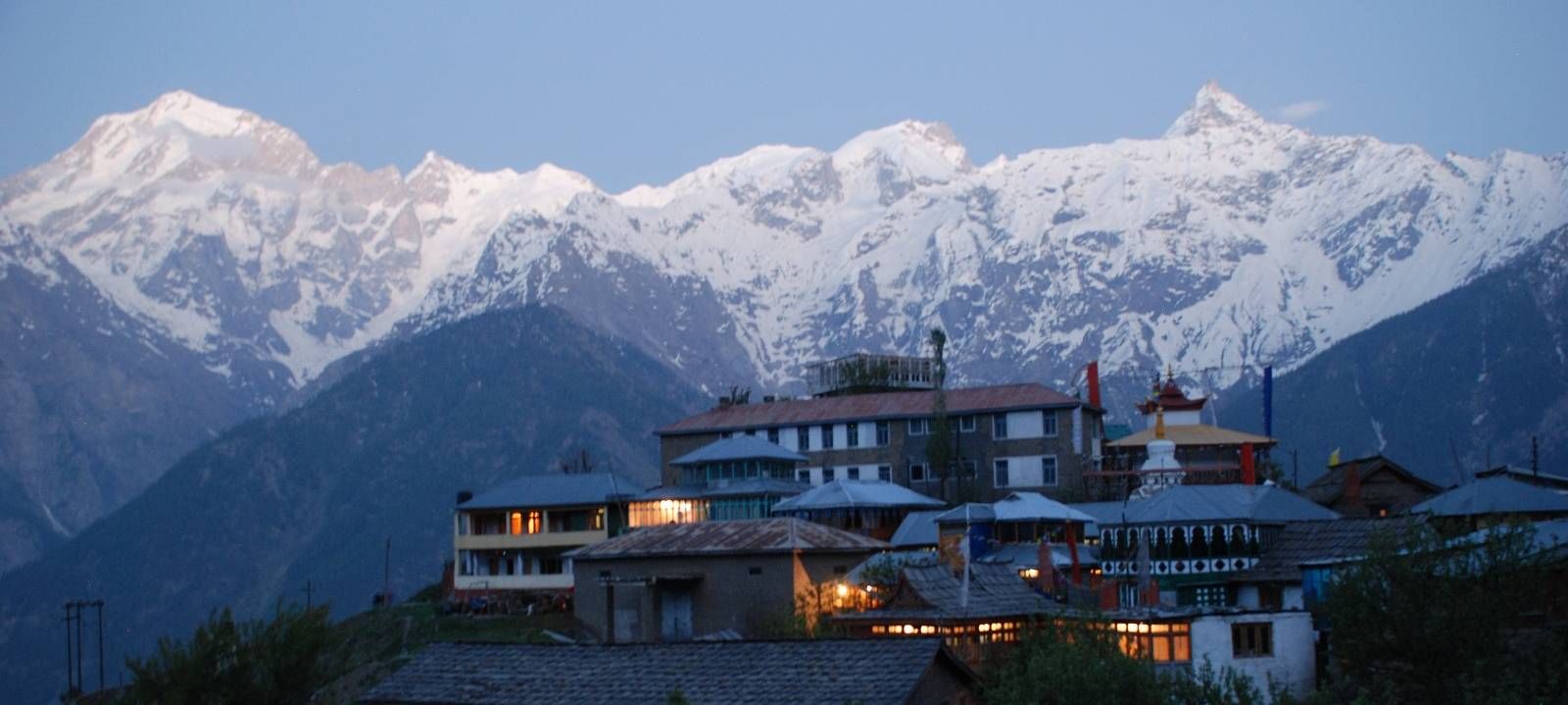
Day 7: Nako to Tabo
Today's cycling begins with a gentle uphill ride for around 3 km to Malling Nalla. We have a steep drop for the next 20 km cycling on narrow surfaced road, with bare rock face on one side and a sheer drop on the other. Near the bottom we ride a long series of exhilerating switchbacks. The bends are very tight and this is a thrilling stretch of cycling. The next 8km of biking are on fairly flat road with a few rough patches. At Sumdo there will be another inner line permit inspection. Pare Chu River flows in here from Tibet and the valley opens out into wider terrain. In Tabo you can visit the Monastery built in 996 A.D.
Cycling Distance: 69km (43 miles)
Altitude: 3,400m (11,154ft)
Accommodation: Guest House (B,L,D)
Day 8: Tabo to Kaza
From Tabo we begin on mainly flat unpaved road with a few downhill stretches. There are stunning views of the Spiti valley. At Schichling we stop to visit Dhankar Monastery (1100 years old). The road is a mix of surfaced and rough stretches on mainly flat terrain to Rangrik. From here we continue on a further 5 km to Kaza.
Cycling Distance: 48km (30 miles)
Altitude: 3,500m (11,482ft)
Accommodation: Camping (B,L,D)
Day 9: Kaza Rest day
There are a few places of interest nearby you may like to visit today. Ki Monastery (17 km from Rangrik) is an 11th C training monastery for Lammas and home to around 100 monks and nuns. There are ancient Buddhist scrolls and paintings which were brought here from Tibet over 500 years ago. Another 5km takes us up to Kibber Village – the world’s highest village accessible by vehicle, the village is very close to the Tibetan border so it is usual for army officials to be in the area. Kaza – the biggest town in the valley has internet (intermittently), an ATM, a German bakery, and phone facilities.
Altitude: 3,500m (11,482ft)
Accommodation: Guest House (B)
Day 10: Kaza to Losar
We begin on fairly good road passing through lovely traditional villages: Hull, Pangmo, and Kyato. Towards the end of the day we are cycling on rougher rocky surface. We camp tonight at Losar at the Base of the Kunzum Pass.

Cycling Distance: 45km (28 miles)
Altitude: 4,250m (13,943ft)
Accommodation: Camping (B,L,D)
Day 11: Losar to Chattru
We begin cycling with a long uphill stretch to Kunzum La Pass (4590m). At the top of the pass it is customary to perform a respectful circuit around the stupa and Kunzum Mata (goddess) Temple and ask for continued safe travels. There are beautiful views of the Zanskar range and the Lahaul Valley. Once over the pass we have a final downhill stretch of cycling for 12km to Bata from here the rocky challenging road runs along the Chandra River to our camp site at Chattru; a small village in a beautiful narrow valley and a green oasis amongst barren surroundings.
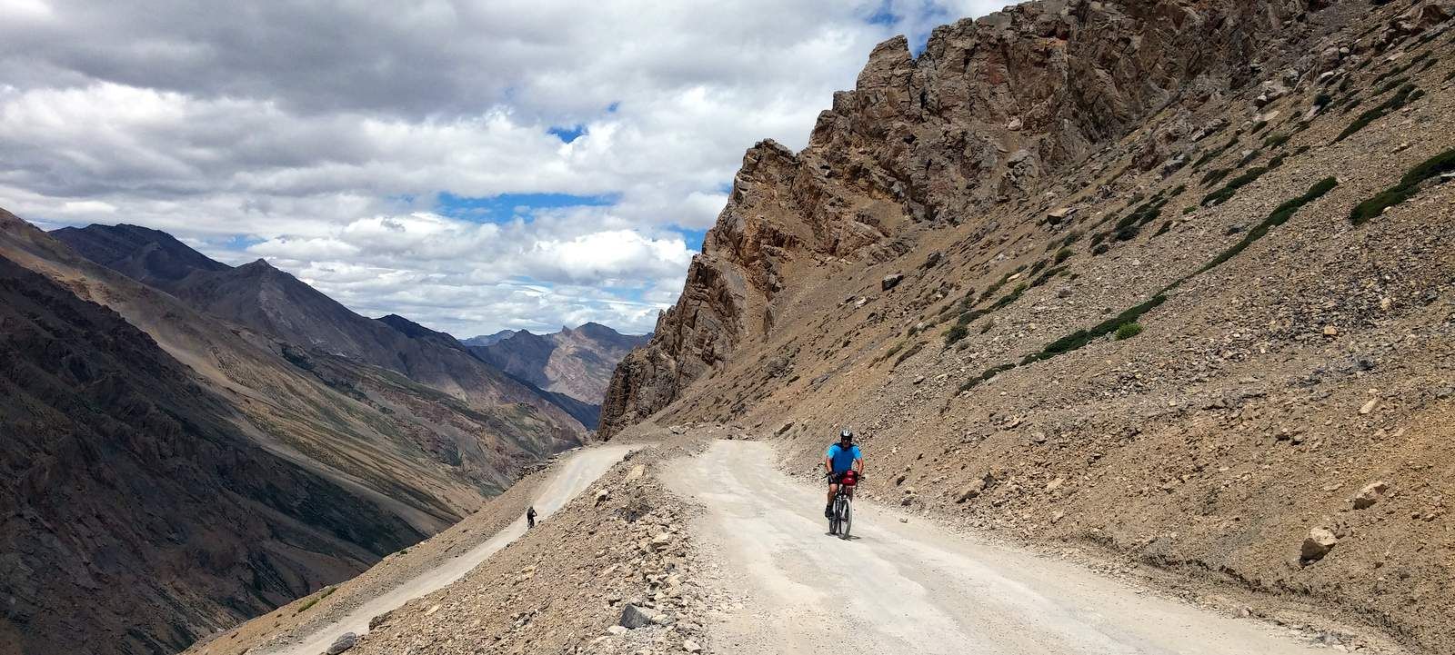
The road today is the roughest of the tour with a distinct lack of tarmac and embedded and loose rocks.
Cycling Distance: 48km (30 miles)
Altitude: 3,500m (11,483ft)
Accommodation: Camping (B,L,D)
Day 12: Chattru – Sissu
On our cycle tour towards Ladakh, today we climb steadily on a relatively good road, first with a series of zigzags then sidle to meet the main Manali to Leh road. In places we negotiate streams that flow across the road. From the junction it is a rutted dirt (possibly mud) road down to the village of Khoksar and another permit check. We continue on a good, mostly sealed and downhill road to Sissu in the foothills of the Pir Panjal range.
Cycling distance: 48km (30 miles)
Altitude: 3,500m (11,483ft)
Accommodation: Camping (B,L,D)
Day 13: Sissu to Jispa
We set off with a short ride to Keylong keeping high on the valley side with several large up and downs on mostly good roads. You will notice that the terrain is becoming much more arid. From Keylong we start with a steady climb and then the day ends with a long downhill into the hamlet of Jispa where we end the day on the bikes. This will be a relatively easy day of cycling.

Cycling Distance: 48.5km (30 miles)
Total Climb: 951m (3,120ft)
Total Descent: 685m (2,247ft)
Altitude: 3,350m (10,990ft)
Accommodation: Hotel (B,L,D)
Day 14: Jispa to Zing Zing Bar
Leaving Jispa we come out of a gorge and briefly ride downhill before starting the ascent to Patseo crossing some streams that flow across the road. We begin to get a sense of the remoteness of our surroundings, with just a few sheep dotted here and there. Travelling on, we enter territory occupied by Lamas. On the horizon you can see the bleak, awesome spectacle of the Higher Himalayan ranges. Cycling from Patse we continue our climb for a further 10km to Zing Zing Bar then ride on a further 5 km up a series of zigzags to reach our campsite. Road conditions are good – mostly sealed with short sections under repair.
Cycling Distance: 36.5km (22.5 miles)
Total Climb: 1,158m (3,799ft)
Toal Descent: 172m (564ft)
Altitude: 4,020m (13,188ft)
Accommodation: Camping (B,L,D)
Day 15: Zing Zing Bar to Sarchu
The hard long climb cycling to the Baralacha La Pass continues today. However tough, the cycling is rich in rewards as we travel through wild, scenic country. The pass itself is arid with no vegetation, and the mountainside resembles a quarry, covered with loose rocks and gravel. Descending into the gorge area of Bharatpur we cross mountain rivers en route to our campsite 6km before Sarchu. Tonight you will wonder at our magnificent surroundings in a wide open valley surrounded by impressive mountains.
Cycling Distance: 41.5km (26 miles)
Total Climb: 840m (2,755ft)
Total Descent: 658m (2,518ft)
Altitude: 4,255m (13,960ft)
Accommodation: Camping (B,L,D)
Day 16 Sarchu – Rest Day
Sarchu is on the boundary of Himachal Pradesh and Jammu and Kashmir between the Baralacha La and Lachlung La passes. Sarchu is important mainly due to its location on the Leh-Manali highway. It is a busy stopping point from the months of May to September the only time of the year that the Leh-Manali road is accessible. Sarchus was an important trading point on the ancient Silk Route and is still a vibrant market place for traders, nomadic tribes and adventure travellers.
Altitude: 4,255m (13,960ft)
Accommodation: Camping (B)
Day 17: Sarchu to Whisky Nullah
The day starts with some easy cycling along the river valley but we are soon tackling the twenty-one zigzag Gata Loops 15,030ft up the canyon wall. These have a good gradient and road surface but above the loops comes a steeper push to the summit of the Nakeela Pass. Following our exertions to the peak we cycle a downhill to Whisky Nullah through beautiful arid mountain scenery of the high ranges.

Cycling Distance: 83.5km (52 miles)
Total Climb: 1,274m (4,180ft)
Total Descent: 1,100m (3,608ft)
Altitude: 4,750m (15,583ft)
Accommodation: Camping (B,L,D)
Day 18: Whisky Nullah to Tso Kar Lake
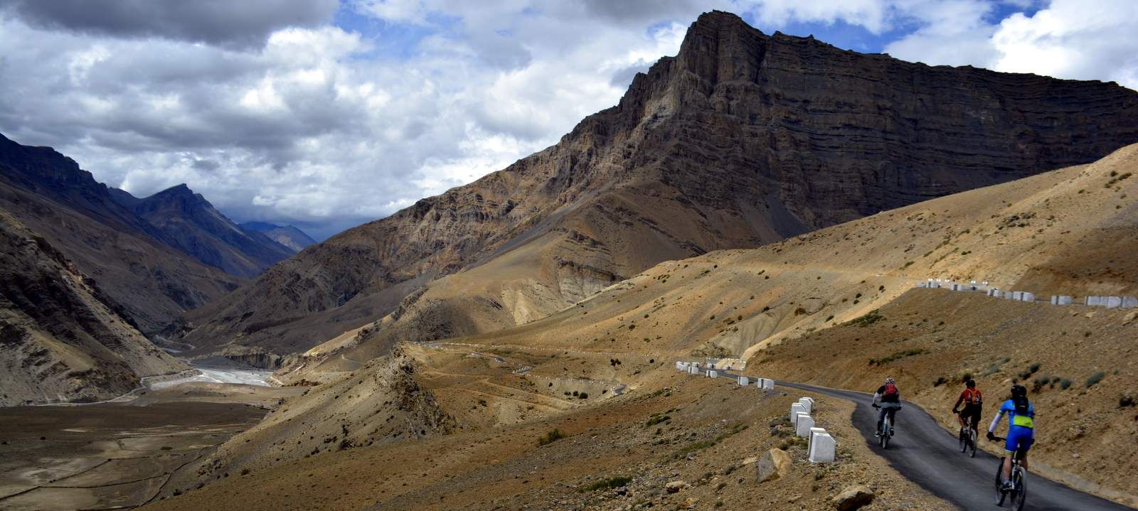
We begin today ascending the zigzags on the road ahead that have been visible from our campsite as we cycle to reach the second highest pass on the Manali-Leh highway; Lachulung La. The recently sealed road has only a few rough patches. We have a long descent riding to Pang down a steep sided gorge followed by an 8km switchback climb before we reach the flat top of the Moray Plains. This barren area is known for its extreme temperatures in the morning and evening, fast winds and sandstorms. The only sign of life is the hardy Nomadic Changpas who can be seen tending their yaks and sheep in this most desolate of places. We continue across the plane, mostly downhill on a very good road which even has a white centreline! We turn off onto a rough sandy track cycling for 5 km to reach our campsite near the shores of the high mountian Tso Kar fluctuating salt lake.
Cycling Distance: 44.5km (28 miles)
Total Climb: 321m (1,053ft)
Total Descent: 252m (826ft)
Altitude: 4,650m (15,255ft)
Accommodation: Camping (B,L,D)
Day 19: Tso Kar Lake to Lato
Today's cycling is a challenge indeed, as we head to the world's second highest pass, the Taglang La at 5,328m. A tough day of riding but the road conditions are good and we are cycling on sealed road almost the whole way. It is truly satisfying when you reach the top. We set off again riding down the exhilarating 1,200m descent of switchbacks to the village of Rumptse. As we we enter into populated and more fertile terrain we pass through tiny hamlets. The air feels warmer as we cycle on to the village of Lato nestled under immense rock faces.
Cycling Distance: 70.5km (44 miles)
Total Climb: 493m (1,617ft)
Total Descent: 1,006m (3,300ft)
Altitude: 3,650m (11,975ft)
Accommodation: Camping (B,L,D) 
Day 20: Lato to Leh
Cycling ever closer to Leh we continue riding uphill to Upshi. The scenery changes dramatically; as we enter a fertile irrigated river valley dotted with pretty villages and Stupas. The spectacular red-hued mountains around us add to the beauty and richness of our environment. Crossing the Indus River the road improves as we ride towards Leh. This is an easy stretch to cycle, we pass the Thiksey Monastery and the Chortens Garden en route.

Cycling Distance: 69.5km (43 miles)
Total Climb: 525m (1,722ft)
Total Descent: 1,056m (3,464ft)
Altitude: 3,500m (11,482ft)
Accommodation: Guest house (B,L)
Day 21: Leh
Taking a rest from the bikes today you have some down time on our Spiti to Ladakh tour to wander at your own pace around the twisting narrow streets of Leh. The town is a popular tourist destination; there are many cafes and sites of historical interest to explore such as Leh Palace or the Sakar Gompa monastery.
Altitude: 3,500m (11,482ft)
Accommodation: Guest house (B)
Day 22: Leh to The Khardung-La Pass
We set off for the Khardung - La Pass at daybreak. Cycling twenty-six miles and gaining 2,000m (6,600ft), this is the ultimate challenge of the trip. It is the highest motorable road in the world taking you to a dizzy 5,600m! The view from the top is spectacular, stretching from the Indus valley in the South over the endless peaks and ridges of the Zanskar range to the giants of the Saser Massif in the North. You can feel truly proud of your achievements as you finish the trip with a final thrilling descent.
Cycling Distance: 79.5 km (49 miles)
Total Climb: 2,165m (7,103ft)
Total Descent: 2,165m (7,103ft)
Altitude: 5,600m (18,373ft)
Accommodation: Guest House (B,L)
Day 23: Leh to home
redspokes Spiti to Ladakh cycling tour ends this morning. You will be transferred to the airport in Leh for your departure flight.
Altitude: 3,500m (11,482ft)
Meals: Breakfast
If you need assistance or wish to discuss the tour, please feel free to call us on +44 (0) 1463 417707.
Alternatively, you can email us on office@redspokes.co.uk for more information on this adventure holiday.
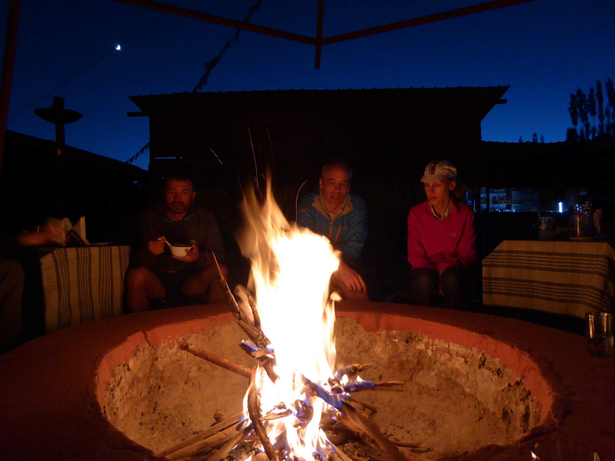
Customer Testimonial
"This trip is everything it shapes up to be and more. Truly something to give memories for a lifetime. It's hard, so the better you prepare, the more you enjoy..."
Graham Crawford
.jpg)