")
")
")
")
")
")
")
.jpg)

.JPG)
.JPG)
.jpg)
Itinerary - Tajikistan to Kyrgyzstan
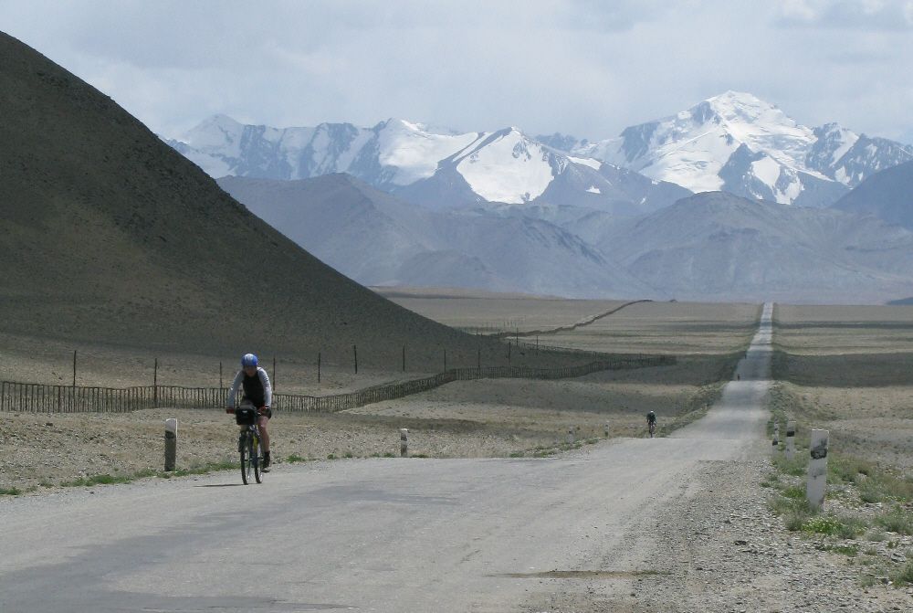
The Pamir Highway
Day 1: Dushanbe
redspokes' Tajikistan to Kyrgyzstan cycling tour begins in Dushanbe. On arrival, you will be met at Dushanbe airport and taken to your guesthouse. If you have arrived on an early morning flight you can arrange to check in early (for an additional charge) and catch up on your sleep (flights arrive at 4am). You are free today to explore the relaxed, leafy capital of Tajikistan. We will have a group meeting and trip briefing this evening.
Accommodation: Hotel (D)
Day 2: Dushanbe - Kalaikumb
Today we transfer by vehicle heading towards the Pamir over the Shurabad mountain pass. As our journey progresses the road becomes very rough. Along the way we may see men and women toiling in the fields using scythes and other traditional farming methods. Over the pass the road meets with the Pianj River which marks the border between Afghanistan and Tajikistan. From here onwards we will enjoy views of the Pamir Mountains.
Accommodation: Guest House (B,L,D)
Day 3: Kalaikumb - Khorog
Today we continue with a short transfer before our cycling begins. As we reach the Pamir region (GBAO province) the landscape changes from lowlands to huge mountains. From Rushan we set off on our bikes, heading along the deep Pyanj valley towards Khorog. Afghanistan is just a short distance away across the river. The road rises and falls along this steep rocky valley as we cycle through small villages and apricot orchards. It will take most of the day to cover the distance to Khorog as we acclimatise to cycling at 2,000m above sea level.
Cycling Distance: 62km (39 miles)
Total Climb: 557m (1,827ft)
Total Descent: 376m (1,233ft)
Sleeping Altitude: 2,050m (6,726ft)
Accommodation: Guest House (B,L,D)
Day 4: Khorog - Rest Day
Khorog is the capital of (GBAO) Gorno-Badakhshan region; you have time today to visit the bazaar, the museum and 100 year old botanical gardens (Just outside the town on the road towards Roshtkala). You can sample some traditional Pamiri food. Typical dishes include laghman, manti, plov and other Central Asian classics, served with bread.
Khorog is situated in a beautiful mountain valley along the Gunt River there are many NGO's working here, with the Aga Khan Foundation taking the lead. Near Khorog there is a weekly market where Afghans and Tajiks can meet, talk and trade.
Accommodation: Guest House (B)
Sleeping Altitude: 2,050m (6,726ft)
Day 5: Khorog - Darmadar
Today we continue our Pamir Highway cycling tour, riding along the valley. Our cycling route follows the Panj River upstream to Andarob for 44 km, we then ride a further 7km to Garam Chashma. This area is known for its hot springs which are popular with local communities. We can partake in a hot soak, a welcome reward for tired legs. The springs are characterised by distinctive calcium deposits and they are believed to have healing powers.
Cycling Distance: 45km (28 miles)
Total Climb: 822m (2,696ft)
Total Descent: 384m (1,260ft)
Sleeping Altitude: 2,575m (8,448ft)
Accommodation: Homestay (B,L,D)
Day 6: Darmadar - Ishkashim
Our ride continues today as we cycle through an historic area, known for its gemstone mines. It is even referred to by Marco Polo in his writings. As we cycle south of Anderob we will see the Koh-i-lah ruby mine set back from the road. You have clear mountain views of the Afghan side of the Wakhan Valley from here. Tonight we stay in Ishkashim, the Wakhan's regional centre and largest village. We will be welcomed by friendly and curious local children. Ishkahsim is home to a lively bazaar.
Cycling Distance: 75km (47 miles)
Total Climb: 572m (1,877ft)
Total Descent: 646m (2,119ft)
Sleeping Altitude: 2,465m (8,087ft)
Accommodation: Guesthouse (B,L,D)
Day 7: Ishkashim - Yamchun
We ride today on the northern side of the Panj, following the river upstream. There are fantastic views of Afghanistan and the snow-capped Hindu Kush Mountains which rise up to the skyline on the far side of the water. Whilst on our side of the river we follow a well beaten track, over on the Afghan side there is only a dirt trail for people and donkeys to journey on. 15km beyond Ishkashim along the road to Namdguti, we pass the Khakha Fortress.
This impressive landmark dates back to the third century BC and rises out of a natural rock platform. It is currently used by Tajik Border guards, so it is best to check before taking any photos. 300m further from along the road from here is the Ismaili mazar (tomb) of Shah-i-Mardan Hazrati Ali, one of many places in Central Asia that claim to be the final resting place of the Prophet's son-in-law.
We end the day in village of Yamchun.
Cycling Distance: 73km (45 miles)
Total Climb: 915m (3,002ft)
Total Descent: 690m (2,264ft)
Sleeping Altitude: 2,782m (9,127ft)
Accommodation: Guest House (B,L,D)
Day 8: Yamchun - Rest Day
An important day to acclimatise and get ready for the hard cycling days ahead. Today there is time to visit Yamchun's stunning 3rd Century BC fortress and take a soak in the Bibi Fatima hot springs. The waters of the springs are believed to increase a woman’s fertility. As a result they are a popular destination for Tajik women. This area is one of the most spectacular area of the Wakhan. The ruins of the 12th-century Yamchun Fort, magical amidst Tajikistan's Pamir Mountains, are just below the spring.

Accommodation: Guest House (B)
Sleeping Altitude: 2,782m (9,127ft)
Day 9: Yamchun - Langar
Today is a short cycling day as we continue to follow the Panj River upstream. After 7km we arrive for our first stop in the village of Vrang, where we will find a ruined fortress and some interesting 4th C Buddhist Stupas. There are sulphurous traces of geothermic activity and many caves around the area. Around 16km from Vrang we pass hot springs that are popular with the local community. Cycling a further 4km along our way, across the river we will see the ruined Afghan fort of Qala-i-Panja. This was once the largest settlement in the Wakhan.
We continue cycling for a further 29km coming to Abrashim Qala (Vishim Qala in Wakhi), the 'Silk Fortress' of Zong. The fortress was built to guard this stretch of the Silk Road from Chinese and Afghan invaders. There are wonderful scenic views of the valley from here. Our destination for this evening is Langar. Langar marks the start of Afghanistan's Upper Wakhan, or Sarkhad region, located at the point where the Pamir and Wakhan Rivers join to form the Pyanj.
Cycling Distance: 42km (26 miles)
Total Climb: 310m (1,017ft)
Total Descent: 250m (820ft)
Sleeping Altitude: 2,824m (9,265ft)
Accommodation: Homestay (B,L,D)
Day 10: Langar - Kargush
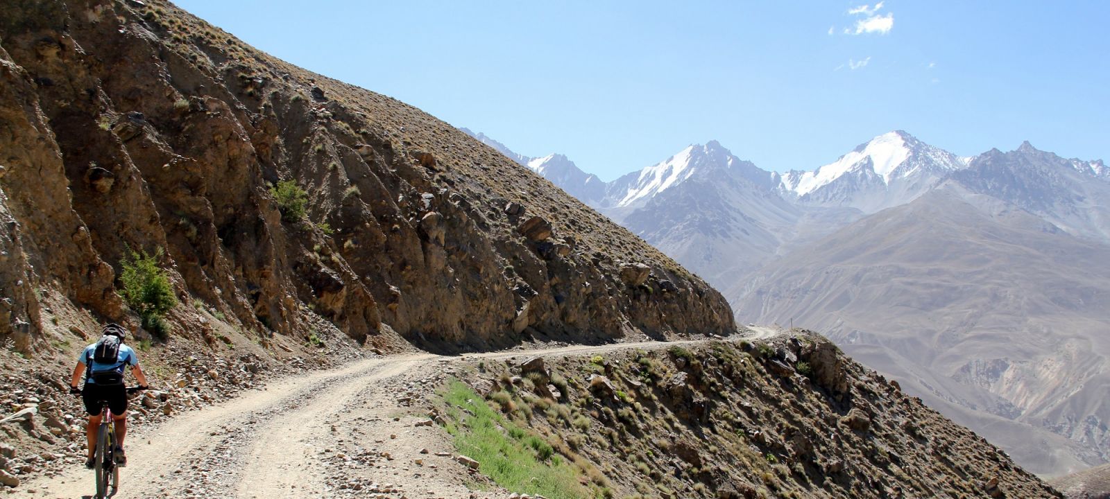
Today we will cycle a long, tough ride. The sandy roads combined with a lack of oxygen make this one of the hardest days of the trip. However the stunning views of the Hindu Kush on the Afghan side of the river make it all worthwhile. Soon after we depart Langar, we leave the Panj River behind, we then cycle a route that follows the Pamir River upstream. The Pamir River is much smaller than the Panj, so we have a closer view of Afghanistan. The road is quite rough with loose stones so we need to take care. Keep an eye out for Bactrian camels on the far (Afghan) side of the Pamir River. We camp just after the military check post at Khargush.

Cycling Distance: 68km (42 miles)
Total Climb: 1,560m (5,118ft)
Total Descent: 395m (1,296ft)
Sleeping Altitude: 3,960m (12,992ft)
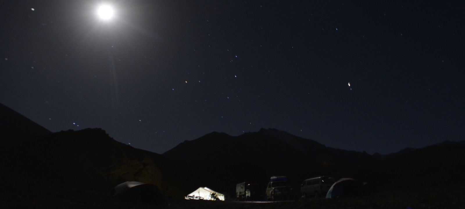
Accommodation: Camp (B,L,D)
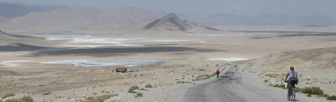
Day 11: Kargush - Yashilkul Lake
Today's ride begins with a gruelling 10km cycle to the top of the 4,344m Kargush Pass. This is our highest point so far, on the least visited mountain range in the world. From here we will have a clear view of the Koh-i-Pamir massif in Afghanistan. We ride on for a further 22km mainly descending on difficult, sandy roads until we re-join the Pamir highway. After another kilometre we are riding off road again towards Lake Yashilkul, a fresh water lake surrounded by wet lands, sand and pebble shores, at an altitude of 3700m.
We stop at a small cluster of houses close to the lake where we will stay the night. Later this afternoon we can visit the eastern lakeside and go for a dip in the small hot springs.

Cycling Distance: 48km (30 miles)
Total Climb: 560m (1,837ft)
Total Descent: 743m (2,437ft)
Sleeping Altitude: 3,604m (11,824ft)
Accommodation: Camp (B,L,D)
Day 12: Yashilkul Lake - Bash Gumbez
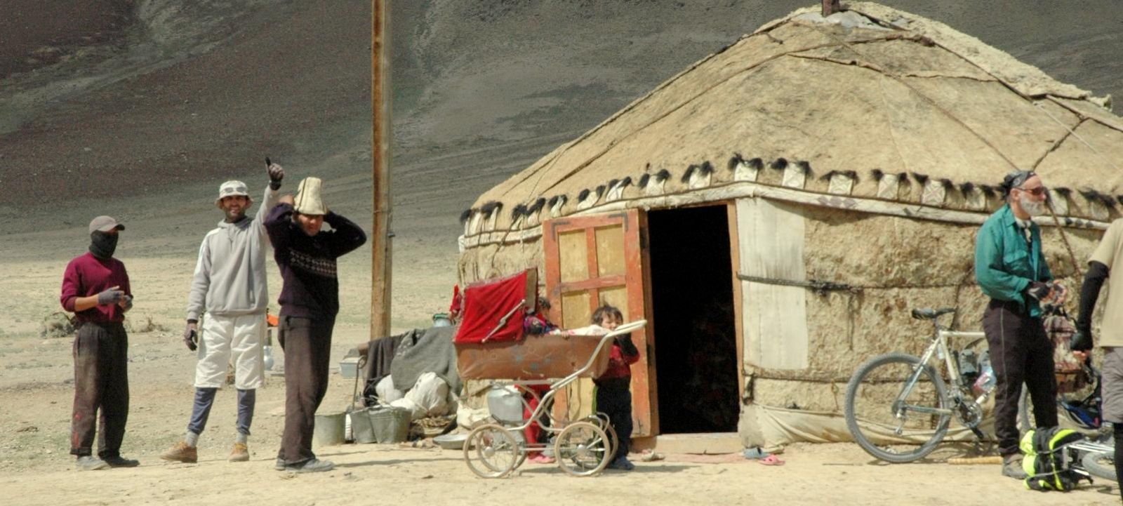
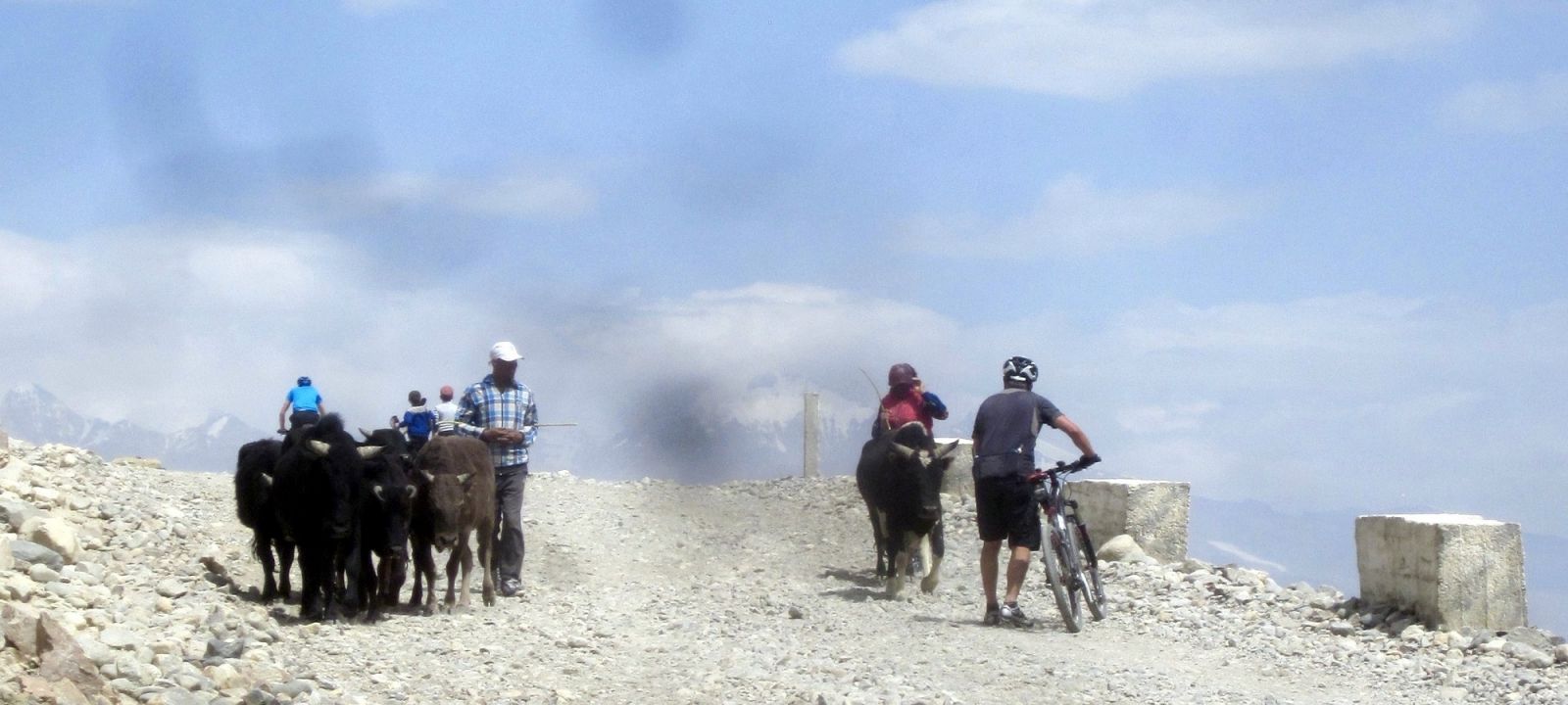
We start the day cycling off road around the eastern part of lake where the waters have an emerald hue. Yashilkul means ‘the green lake'. The lake’s deepest point is 50m from the surface and is 19km long. The water is clean and clear; trout and marinka fish are visible from the surface. We cycle on re-joining the Pamir Highway at Alichur where we will stop for lunch. This afternoon we ride a further 26km along a route that passes nomding dwellings, yak and moonscape terrain to reach our Yurt camp.
Cycling Distance: 82km (51 miles)
Total Climb: 620m (2,034ft)
Total Descent: 395m (1,296ft)
Sleeping Altitude: 3,938m (12,919ft)
Accommodation: Yurt (B,L,D)
Day 13: Bash Gumbez - Murghab
Today ride begins with a gentle 30km climb to the summit of Niezatash Pass (4,314m). This is followed by a lovely descent as we cycle on to Murghab – Tajikistan’s highest town at a dizzying altitude of 3,650m. The ride feels like the true bam-i-dunya (roof of the world). We will stay tonight in a friendly guesthouse and can stock up on supplies in the small bazaar.
Cycling Distance: 78km (48 miles)
Total Climb: 1,497m (4,911ft)
Total Descent: 1,946m (6,385ft)
Sleeping Altitude: 3,618m (11,870ft)
Accommodation: Guest House (B,L,D)
Day 14: Murghab - Rest day
Murghab is the highest town in Tajikistan at an altitude of 3,650m. It was built at the meeting point of the Pamir Highway and the Murghab River and is the capital of the Gorno-Badakhshan Autonomous Region. In the Persain language Murghab means 'river of the birds'.
Sleeping altitude: 3,618m (11,870ft)
Accommodation: Guest House (B)
Day 15: Murghab - Ak Baytal Pass
Cycling distance won't be a problem today; the challenge is the thin air as we cycle through increasingly sparse but beautiful scenery all the way towoard the Ak Baytal Pass and our camp/lodgings at over 4,400m.
Everyone will want a good night's rest before our final mountain pass tomorrow which can be difficult at this altitude. It is usual to experience fragmented sleep at these heights.
Cycling Distance: 49km (30 miles)
Total Climb: 857m (2,812ft)
Total Descent: 49m (161ft)
Sleeping Altitude: 4,429m (1,4531ft)
Accommodation: Camping/lodging (B,L,D)
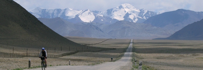
Day 16: Ak-Baital Pass - Kara Kul
We start the day with a steep 3km (300m) climb to the summit of Ak Baital Pass at 4,655m, the high point of the trip! Although it's a steep climb in the thin air, it is not desperately long.
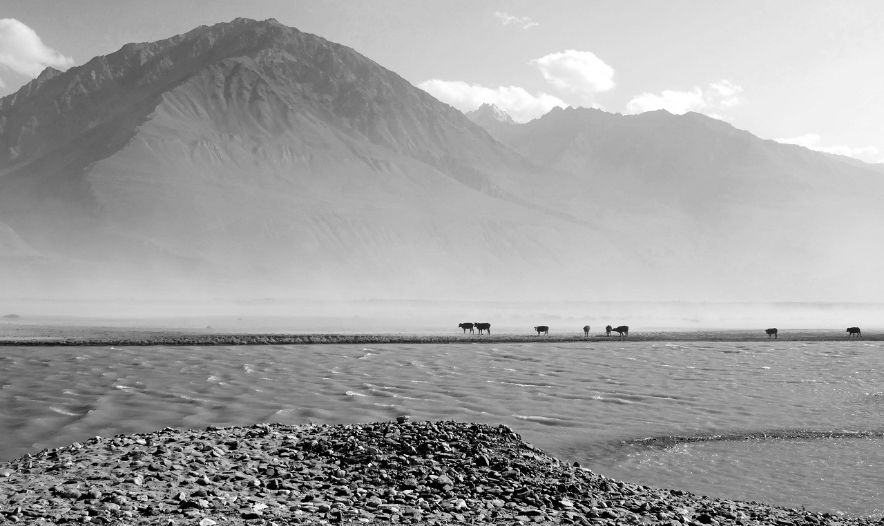
After riding very rough, equally steep 7km descent from the pass we ride a gentle 58km through the remote valley that leads us to the lakeside settlement at Kara Kul. Formed by a meteorite some 10 million years ago the lake at Kara Kul is a hauntingly beautiful place with a stunning view of the Pamir Mountains. Today is undoubtedly one of the highlights of the trip.
Cycling Distance: 62km (38.5 miles)
Total Climb: 399m (1,309ft)
Total Descent: 860m (2,822ft)
Sleeping Altitude: 3,768m (12,365ft)
Accommodation: Homestay (B,L,D)
Day 17: Kara Kul to - Sary Tash
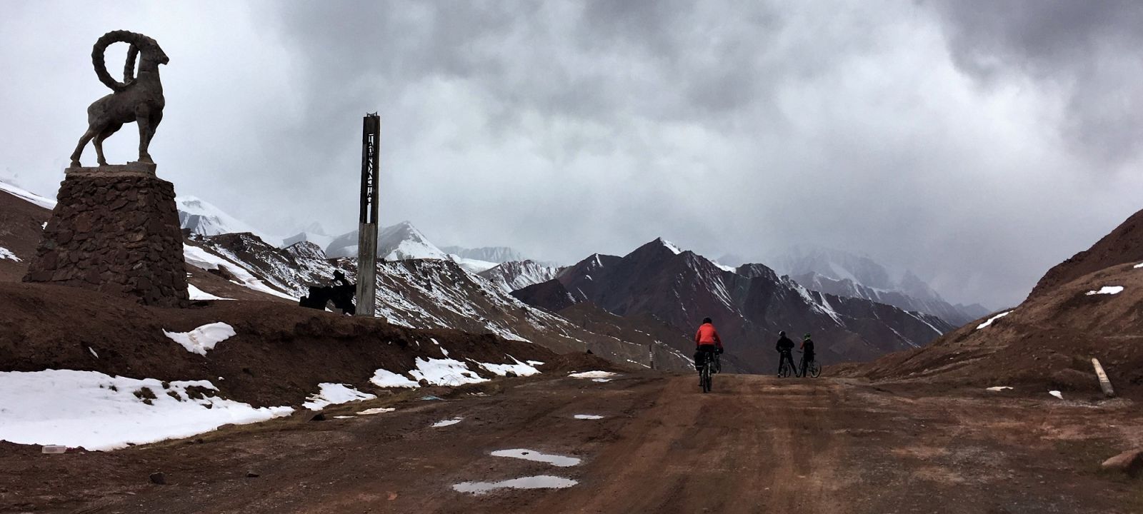
We continue biking around the lake for a flat 20km before cycling the first of two climbs to the Kyzl-Art Pass, the border point between Tajikistan and Kyrgyzstan.
After a thorough security check at the border, a very rough descent takes us into the wide Alay valley. We have spectacular views of the 7,000m summits of Koh-I-Samani and Koh-I-Garmo. The valley is a favourite spot for Kyrgyz nomads and the grasslands are studded with their traditional yurts. Tonight, we stop in Sary-Tash, a tiny remote village surrounded by picturesque mountains.
Cycling Distance: 94km (58 miles)
Total Climb: 756m (2,480ft)
Total Descent: 1,307m (4,288ft)
Sleeping Altitude: 3,169m (10,397ft)
Accommodation: Yurt/homestay (B,L,D)
Day 18: Sary Tash - Bishkek
Today we will transfer by road to Osh (about 3 hours). We take an afternoon flight to Bishkek.

Accommodation: Hotel (B)
Day 19: Bishkek - Home
redspokes Tajikistan to Kyrgyzstan: Pamir Highway tour ends this morning. You will be transferred to the airport this morning for your flight home.
If you need assistance or wish to discuss the tour, please feel free to call us on +44 (0) 1463 417707.
Alternatively, you can email us on office@redspokes.co.uk for more information on this adventure holiday.
-001.JPG)
-001.jpg)
-001.jpg)
-001.jpg)
Customer Testimonial
"What a wonderful trip to this remote part of the world. My highlight was seeing the snow capped Hindu Kush Mountains in Afghanistan as we cycled the Wakhan Corridor! To share..."
Mathis Trepp
.jpg)